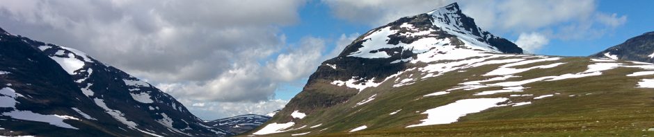
I have been playing with the GPS on my new phone — let’s face it: you can’t do more than play — and found a wonderful site here, which offers a split screen view, with a large scale Ordnance Survey map on one side, and a satellite view on the other. On the OS map, you can mark out routes, which can then be exported in XML to the phone; and if you have OS maps on the phone, too, courtesy of Viewranger, then the whole route is available in a pocket. It’s much easier to plot a route on a big screen than on the phone. Viewranger, incidentally, offers maps of Finland and Slovenia as well as Great Britain, and is hoping to do Norway and Sweden too, soon. And OS-type maps are much better than Google for walking and looking.
-
Archives
- October 2019
- September 2019
- November 2018
- August 2018
- July 2018
- January 2018
- November 2017
- October 2017
- September 2017
- July 2017
- December 2016
- October 2016
- May 2016
- March 2015
- April 2011
- March 2011
- April 2010
- February 2010
- January 2010
- December 2009
- November 2009
- September 2009
- August 2009
- July 2009
- June 2009
- April 2009
- March 2009
- February 2009
- January 2009
- December 2008
- November 2008
- October 2008
- September 2008
- August 2008
- July 2008
- June 2008
- May 2008
- April 2008
- March 2008
- February 2008
- January 2008
- December 2007
- November 2007
- October 2007
- September 2007
- August 2007
- July 2007
- June 2007
- May 2007
- April 2007
- March 2007
- February 2007
- January 2007
- December 2006
- November 2006
- October 2006
- September 2006
- August 2006
- July 2006
- June 2006
- May 2006
- April 2006
- March 2006
- February 2006
- January 2006
- December 2005
- November 2005
- October 2005
- September 2005
- August 2005
- July 2005
- June 2005
- May 2005
- April 2005
- March 2005
- February 2005
- January 2005
- December 2004
- November 2004
- October 2004
- September 2004
- August 2004
- July 2004
- June 2004
- May 2004
- April 2004
- March 2004
- February 2004
- January 2004
- December 2003
- November 2003
- October 2003
- September 2003
- August 2003
- July 2003
- June 2003
- May 2003
- April 2003
- March 2003
- February 2003
- January 2003
- December 2002
- November 2002
- October 2002
- September 2002
- August 2002
- July 2002
- June 2002
-
Meta
Something somewhere between this and http://www.bikehike.co.uk would be perfect. Bikehike has lots of nice cylists’ gizmos like profiles and gradients, and has also implemented google “follow road” routing. It also has a facility to save and reload routes.